chumash / rocky peak / hummingbird

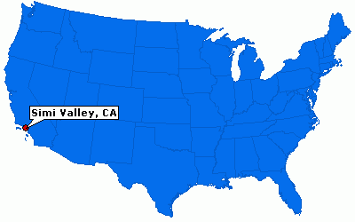
(via epodunk.com)
this entire ride is in the exposed desert hills above simi valley. very little flora, very little shade. lots of rocks, sandstone, and lizards. it doesn’t sound gorgeous, but it is.
chumash trail starts at the end of flanagan drive in simi valley. start with a half hour of fairly steep steady climbing. it gets rocky in places, the higher you go, the bumpier the trail gets. we spent maybe 25% of the trail doing hike-a-bike. a little narrow and dusty, but nothing too scary.
when you get to the top/end of the 3-4 miles of chumash, turn right onto the rocky peak fire road. the fire road swoops up and down like a roller coaster, and since it’s mostly paved with grippy sandstone, you can get going pretty fast – just keep an eye out for hikers and shirtless sweaty hardcore trail runners. we even came across a biker that was scoping out the trail for his elementary school cross country team, with some kids as young as 8 or 9. west coast athletes start so young!
after a mile or so on the fire road, you’ll come across a ridge with a panoramic view of simi valley and moorpark. slow down and see if you can pick out the antibiotic (keeps out the bugs!) house built into the mountains (2 tiny white squarish blocks on the left), the rocketdyne 1959 nuclear meltdown site, and maybe a wildfire or two. if you look directly below you, down the mountain, you can see a bright green oval patch surrounded by white picket fence. some hikers informed us that this is the hummingbird ranch, where they film the reality tv show “the biggest loser”. used to be a polo field too.
2-3 miles of fast fire road later, you’ll see some green benches and signs for the hummingbird singletrack trail. if you continue on the rocky peak fire road instead of turning right onto hummingbird, you’ll end up an extra mile or so east of where you parked, so you’ll need to turn right onto the santa susana pass road. and add that road riding distance to your trek. santa susana turns into kuehner drive, then left onto los angeles ave, right onto yosemite, right back onto flanagan & your car.
if you choose the hummingbird trail option, make sure you bring your top notch handling skills. and your bravado. hummingbird starts off with easy fast singletrack, a little up and down, and then it’s all downhill. there are several spots where the trail seems to disappear into a giant steep slab of sandstone. yep, you’re meant to go down it. just follow the black tire skids. after the sandstone fields, there’s a series of moderately tight switchback turns. watch out, some of them are sandy and a little more difficult to maneuver. at the bottom, the trail will lead you to a big tree and beyond that, up a short steep incline, is a dirt field. follow the tire treads, going nearly straight across it to the fence, and there’s an opening just big enough for bikes and hikers to enter/exit through. the street you’re going downhill on is kuehner. ride ½ a mile and turn right onto los angeles ave. then right on yosemite, over the 118, up a hill, and then right onto flanagan.
i believe you can do this trail backwards too, parking on kuehner, and starting by the fence/dirt lot, and doing the hummingbird singletrack first. of course, that entails riding/hiking up sandstone. if that's your thang, more power to ya!
total 12-13 miles. about 3 hours of riding. this is one of my favorite rides yet. lots of speed, a bit of technical, a great workout.
+++++++++++++++++++++++++
directions:
405 north --> 118 west --> yosemite ave exit
--> right @ yosemite ave
--> right @ flanagan drive
--> street parking on flanagan
about 45 minutes from south bay
google maps
+++++++++++++++++++++++++


1 Comments:
are you actually biking again! Congrats. I've been riding a shit load this summer. I'm up to 1500 miles since march!! yippi
Post a Comment
<< Home