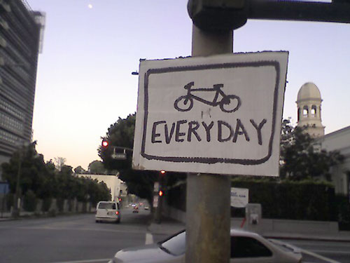
santa susana mtns - mission peak
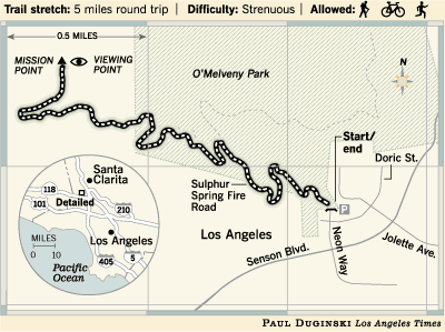
(via latimes.com)
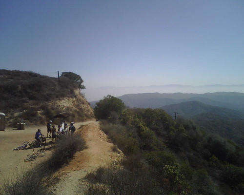
saturday was a short ride, about 10 miles, up and back down mission peak (also called "secret of the three trees") in granada hills. it's about 40 minutes from the south bay, just make sure your car can take the hilly trek up and over the mountains into the valley.
the mission peak climb lasts about an hour, depending on how much you rely on downshifting to an easier (and slower) gear, a distance of about 2.5 miles. in some places it's so steep that hikers will be lapping you, but the views are amazing, so feel free to take your time.
near the top, an iron fence cuts off what used to be a nice easy switchback trail to the summit. after 9/11, the local gas co cordoned off the area to protect the supposed large natural gas deposit from terrorists. but you can easily circumnavigate the fence - well, it's easier if you're on foot. ambitious bikers will have to power up a nearly 60 degree slope that's powdery and loose.
we took the singletrack trail (you can also just go back down the fire road in reverse) down from the almost-summit, accessed via a path through a wire fence that starts to the left of the fire road if you're looking downhill. the singletrack is fun and fast, though pretty technical. it had a few long steep sections that tested the limits of my handling and ability to hold my focus. it's narrow and a little bit rutted too, so there's not a lot of room for error. if you don't know the trail, i def recommend taking it slow. and remember to take a break or two to check out the skyline! gorgeous.
the singletrack spits you out in omelveny park, which is right next to the suburb you parked in. once the easy gravel trail takes you back to paved surface streets, use the map you brought to find the way back to your car.
p.s. it's foggy in the spring
p.p.s. watch out for horses
p.p.p.s. the los angeles times has a nice piece on how to get to the hike/bike trail
*******************UPDATE /01/07 8:43am PST*******************
my friend peter continued on after i decided mission peak had given me enough exercise for the day and here's his tale of how it (another 15 miles of mtn biking) went...
After you left, we picked up the other rider, who was trying to meet us, but kept getting the directions wrong. We then headed off for some single track.
It started out as horse trails (there were those metal railings beside the trail to prevent horses from falling down). The terrain was rolling (not steep) and we worked our way downhill. There were 3 or 4 water crossings! Some of the water/mud that we went through was quite smelly!
There were also a couple of those short, steep drops and climbs that I like to topple over on!
The single track was not too technical, but was twisty enough to be fun. It was also fairly fast (the fast guys put on their body armor).
By 11:30 or 12 I had hit the wall and struggled to keep up (sorry, I didn’t represent us well).
Of the 100 oz of water that I carried, I think I only had about 20 or 30 oz left by the time I got home! I’m glad it wasn’t any warmer than it was.
We got back to Hans’ house about 1-1:30ish.
and the trails they rode...We took the trail just west of Limekiln Canyon Rd. and headed west, along the base of the Santa Susana Mountains.
After a while, it angled slightly north and into some shaded areas. We kept on the westward direction and finally came out at Brown’s Canyon Road.
Took this south and it turned into DeSoto Ave. Took DeSoto to just south of the freeway and turned left onto San Fernando Mission Blvd (it is a dirt access road at this point) and took it east to Limekiln Canyon.
From Limekiln Canyon, we went north a bit and pushed our bikes up a very steep hill to Rinaldi St (the more macho riders tried to ride up the steep hill [several times] and failed, even Louisa!). From Rinaldi, it was just a road ride back to Hans’ house.
***********************END OF UPDATE***************************
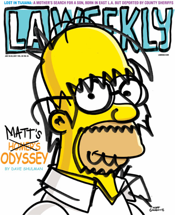
yet more simpsons marketing
the simpsons movie finally opens today.
and i heave a sigh of relief.
because it means the promotional assault will finally let up. even as a long-time simpsons fan (who isn't???), the non-stop ads, high-profile branded partnerships, kwik-e-marts, blog takeovers, digital billboards, static (cryptic!) billboards, movie theater photo ops, simpsonizers, custom simpsons avatars, agricultural mischief, la weekly wrap-arounds, la weekly cover & cover story, couture fashion shoots (my 2nd least hated marketing effort)...
...have all been a bit overwhelming. and i'm sure my list is far from complete. though their efforts have successfully convinced me to see it on the big screen. four weeks after it opens. for three dollars.
and i close with my least hated simpsons movie marketing carpet bomb:
roommates wanted
 ah summer. suntan lotion. boogie boards. and MOVING! i know you wanna.
need roommate for the place i'm moving IN to:
Room for rent near the beach ~ El Segundo (just south of LAX, convenient to Manhattan Beach, Marina Del Rey, and Redondo Beach)
need roommate for the place i'm moving OUT of:
Roommate needed for Sept 1 - all utilities & parking included! ~ Santa Monica (about a mile from the 3rd St Promenade, the Santa Monica Pier, and of course, the beach!)
*******************UPDATE 7/31/07 8:59am PST*******************found roomies for both places! no thanks to you lazy bums. =)
***********************END OF UPDATE***************************
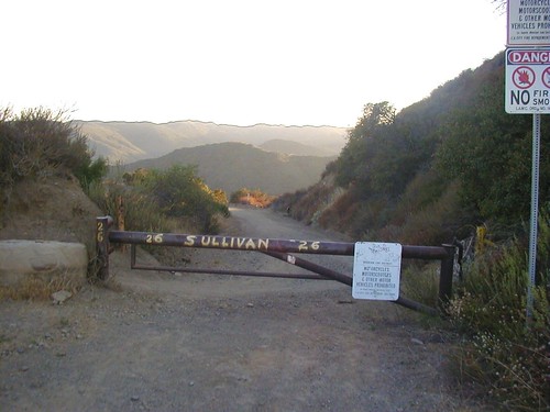
swoopy sullivan canyon
 (via spannertech)
the starting point for saturday's ride was up in the hills above west sunset blvd. beautiful area packed with multi-million dollar homes & their requisite infinity pools, plenty of street parking, and most important, sweepy swoopy trails leading up into the santa monica mountains. had a sizeable group this time: louisa, jen, marizel, peter, ken, jim, matt, gerard, victoria, and moi.
we started off with a few miles of fairly level shaded singletrack, packed with "dipsey doodles" (baby roller coaster rides for your bike), one steep dropoff, and some tight switchback turns. after that warm-up, we hit a mile-long climb that was exposed and gave us the first taste of the afternoon heat. the ascent took us straight up to the fire road/hub, where several trails in the santa monica mountains intersect.
a NIKE station (that i skipped seeing) is located near the sullivan canyon hub. it used to house missiles reserved for attacks on russia and other unsavories of the 1980s. i will take a look next time. there is supposedly a vending machine up there too.
the first singletrack trail that louisa lead us on had a tight switchback turn that led to my first fall of the day - and handlebars twisted out of kilter. ken gave me a manual fix, and then we hit a moderately steep 50' descent covered with loose rocks, denying us any traction and making the bikes pretty much unsteerable. after maneuvering that, we encountered a super narrow (8"-wide for most of it) section that hugged the mountain, had a steep dropoff to the left, and sloped downhill. the trail was in poor maintenance and that, combined with my eternal bullheaded need for speed, provided me with the perfect conditions for a second spill.
we got spit up back onto a surface street, bombed downhill for a mile or two, and hopped on a scenic ride that ran on the bottom of a canyon. of course, what you go down you must come up, and this 2nd steep "up" of the day was a rough one. i made it up with the help of several pit stops and we were once again back on the fire road at the top of the mountain. 15 more minutes of climbing the fire road brought us to the top of the sullivan canyon trail. it was all downhill (and almost no pedaling) from there, and that shaded 1st leg was even better in reverse.
our obligatory post-ride chowfest took place at a votre sante ("to your health") in brentwood. it was surprisingly close to the trail head, and surrounded by plenty of parking. it's a small space, maybe a 20'x 30' seating area, simply decorated with soothing b/w photography. delicious, healthy, colorful food too. i recommend the blackened salmon salad (tender & fresh fish) and the raspberry spritzer (no sugar added!). hopefully i'll have room for a bite of their tempting pies & cakes when i come back for seconds.
18.2 mile ride. 4 total crashes. a zillion calories burned. maybe a zillion and a half. can't wait to do it again next weekend.
jen why

i've been addicted to internet t-vizzle as of late. i finally got to absorb the entire amazing 6 seasons of six feet under, dabbled in entourage, and have found a brand new addiction: wonderfalls.
the show has been kaput since 2004, and i heard a bit of buzz about it when i was living in nyc, but haven't gotten around to actually watching it till about a week ago. brief show synopsis: recent brown u grad works touristy retail whilst undergoing a quarter-life crisis until stuffed animals, plastic toys, and wind up trinkets start giving her quirky cryptic instructions that result in good karma and resolved conflicts.
"karma chameleon", the 3rd of the 13 episodes, is my favorite so far. they discuss the motivations behind "jen why" (gen y), over-educated 20-somethings that are just floating about, unsure what to do or where to go with life, slacking and putting forth as little effort as possible. being in a bit of the same boat, i found it comforting to find out that i'm not alone. that people are aware of my generation's "dilemma"...aware enough to make a show about it. i'm just going to blithely ignore the fact that wonderfalls only lasted one season. i'm still relevant! i think. anyway. i'll just keep flailing about until the "true calling" comes and finds me. heeeeeeeere tc tc tc...
pool invasion
4 hour ride tomorrow. carb fest tonight. see you there locked, lubed, and loaded.
details & directions (via south bay mtn biking club) if you want to try the park out yourself:
+++++++++++++++++++++++++
Sat. July 14: Sullivan Canyon Singletrack to the Intersection of Dirt Mullholland and Fireroad #30. B- level. TS 3 & EL 3. This ride starts on the Sullivan Canyon singletrack with 4 miles of steady climbing. Then we'll go about ½ mile on Sullivan Ridge Fireroad to the Dirt Mullholland Fireroad where we'll turn left for some climbing and descending to the intersection of the fireroad and Fireroad #30. Here we'll turn around and head to Nike Tower, then it's back to our cars by going down to the Westridge Fireroad where there will great views of the Pacific Ocean and Santa Monica (we can ride on the singletracks that are parallel to the fireroad). The distance of this ride is approximately 14 miles and duration is approximately 4 hours.
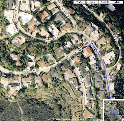
Directions to: 13407 W Bayliss Rd, Brentwood, CA 90049
From South Bay area: Take the 405 north. Exit at Sunset and turn left heading west. Continue to Mandeville Canyon Rd. Turn right and go to first stop sign. Turn left onto Westridge Road. Continue up hill to Bayliss. Turn left at Bayliss and park in that first block. Remember not to yell when you arrive as this is a residential neighborhood. About a 55-minute drive from the South Bay.
+++++++++++++++++++++++++
will rogers / backbone / topanga canyon
Saturday was looking gloomy and overcast - perfect biking weather! Met at Los Liones & West Sunset Blvd at 8am - Ken, Peter, Louisa, Jen, Derald, and me. Parked on the first block of Los Liones, and made the intros. Louisa printed up some SBMBC membership cards for us newbies too. To get to the trail head, we had a bit of road riding to do first. 1/2 mile up West Sunset and left onto Palisades Drive for a few miles, turning left at Verde De La Montura, then immediately right onto Michael Lane. The trail head (Trailer Canyon Fire Road on the map) was about a half mile down Michael Lane on the left hand side. Sidewalk is available to ride for most of the surface street journey, so you're out of the path of cars. Parts are overgrown though, so watch out for weedwhip. Met up with Mark at the trail head, investigated Jen's mysterious squeaky bottom bracket, test rode Louisa's light-as-a-feather Santa Cruz, and we were on our way.
The trails started out with a couple miles of fire road climb, with a few level spots (whew!) scattered throughout. Not quite as steep and intense as the first half of last week's Laguna Wilderness ride, but about twice as long. Utterly exhausting for a coddled midwestern flatlands singletracker like me - I've really got to work on my endurance. I was stuck at the back of the pack all the way up, but the west coast hardbodies barely budged off their big ring! The climb took about an hour and then we reached the "hub", a flat spot where several trails connect, outfitted with a port-a-potty (toilet paper included!), trail map, recycling bins, and a spectacular view.
From there, we hopped on the Will Rogers trail, part of the Backbone trail network. Will Rogers was forested singletrack with a couple short climbs for the first 1/2 mile, and after that, a skinny speedy exposed rocky run that let you go wild for a few miles. We stopped under a large oak tree, our halfway mark, and at that point, our group split in half, as some people were out of water. We had two options:
- "UP": Finish Backbone trail and end up where we had hopped on from the fire road, and cruise down the fire road & surface streets to the cars. The catch was, it involved a LOT of up.
- "DOWN": Ride Will Rogers in reverse and hit a singletrack to the surface streets. The catch there was that you end up a ways downhill of Los Liones and you finished up your ride with hilly heavily trafficked asphalt riding at peak temperatures.
Worried I was close to bonking, I nearly chickened out and initially opted for the easier way "Down", but Jen inspired some wacko part of me to try (her famous last words - "Nothing else on my schedule today!"). The first 1/2 mile of "Up" was tolerable, short twisty climbs with a few fast runs. And then we hit "The Washout" - about a mile of loose rocky poofy exposed 45 degree slope. The climb itself was tough, but with the sun beating down on your back, and the rest of its rays reflecting violently off the white rocks right back into your face, I was riding (ok, ok, 99% walking it) with a hairdryer blowing in my face.
Finally we hit the top of the mountain, took in the sights, and began the descent. Riding the trail back down to the fire road was no problem, and the fire road itself took about 15 minutes to speed down. It was so hard to believe we had climbed up all of it! The valley next to us held some scattered luxury homes and clouds creeping in along side. Everything looked green and luscious and I welcomed the cool breeze that accompanied the progressive drop in elevation.
Once we got back down to the balmy 68 degree perfection of the trail head, Louisa checked her bike computer and declared the day's stats: a 3000 foot climb during our 19 mile trek. Amazingly enough, after baking in the sun for 3 hours without a ghost of a sheltering cloud, the last few miles of Palisades Drive was completely overcast and gusty, and the temp dropped to about 50. We rolled up to the cars completely drained and ravenously hungry. After deconstructing the bikes for travel and shedding the dirtiest of shoes and shirts, we hit up a nearby Greek/Mexican/American joint. They had a million things on their menu, but I settled for the plainest option - a cheeseburger & fries. Toasted bun, freezer-burned patty, crisp greasy fries, and loads of ketchup. There's nothing like a deathly unhealthy hot post-ride meal.
The delicious single track at the top of this ride is worth the sweat and tears, but be prepared for a lot of it - a full CamelBak and 2 Clif Bar's worth, at least. I recommend Laguna for a shorter run and the Santa Monicas for the day after a marathon-prep spaghetti-eating contest.
details & directions (via south bay mtn biking club) if you want to try the park out yourself:
+++++++++++++++++++++++++
Sat. July 7: Trailer Canyon to Will Rogers Trail. B Level. TS 3 & EL 3. This ride starts with an optional few miles riding up Palisades Drive, followed by four miles of climbing on the fire road, up to the top, and about 4 miles down the Backbone oak tree. Then we’ll turn around and head back to our cars.
Directions to: W. Sunset Blvd & Los Liones Dr, Pacific Palisades, CA 90272
From South Bay area: 405N, 10W into PCH north, turn right onto Sunset Blvd., then turn left onto the first street on the left, Los Liones Drive. Park on the first block of Los Liones. If you reach the first traffic light, Pacific Palisades Blvd., you have gone too far. About a 40-minute drive from the South Bay.
+++++++++++++++++++++++++
laguna coast wilderness!

did my first trails ride since the march '06 sedona ibrc alumni trip. it felt so good to be back on the bike, picking lines, bombing downhills, and exerting myself to the point of exhaustion. i had to ride with my clunky heavy downhill pedals (the beloved clipless pedals are en route from brooklyn - how could i leave you behind?!?), so i was extra extra tired at the end of the 3-hour ride. not sure about distance...or the exact trails we rode...but i will certainly be back for more. maybe in october when the 30spf sunscreen can actually stand up to that scorching cali sun. there's more to laguna beach than vapid super spoiled sweet sixteen princesses. thank god.
details & directions (via south bay mtn biking club) if you want to try the park out yourself:
+++++++++++++++++++++++++
Sat. June 30: Laguna Wilderness Park to El Moro and Beyond. B+ Level: TS 3 & TS 3. Lots of ups and downs, plenty of singletrack, and coastal scenery. Trails include John’s Run, Erection, T’n A, BVD, et al.
Directions to coordinates (33.5668, -117.764)
From South Bay area: 405 (SF Valley: 5 South) to 133 South (exit 2 - towards Laguna Beach). 133 becomes Laguna Canyon Road (no turns!). Drive 6.5 miles on 133 and then you'll see a parking lot on the right with a "Laguna Coast Wilderness Park" sign. If that lot is full, drive down another mile or so for the "Big Ben" parking lot, also on the right. Bring $3 for the drop box parking fee.
+++++++++++++++++++++++++


